Encyclopédie Marikavel-Jean-Claude-EVEN/Encyclopaedia/Enciclopedia/Enzyklopädie/egkuklopaideia
|
|
|
||
|
Scotland Bro-Skoz |
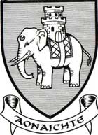
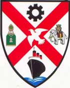
couleurs non définies. Voir blason ci-contre >>> |
West-Dumbarton |
|
Dumbarton Dùn Breatainn, Altclud |
| pajenn bet digoret an 19.04.2011 | page ouverte le 19.04.2011 |
|
* forum du site Marikavel : Academia Celtica |
dernière mise à jour 21/11/2023 10:48:43 |
![]()
|
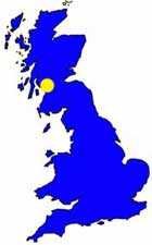
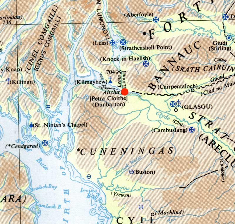
Définition : ville d'Écosse; comté de West-Dumbartonshire, au fond de l'embouchure de la Clyde. |
|
![]()
|
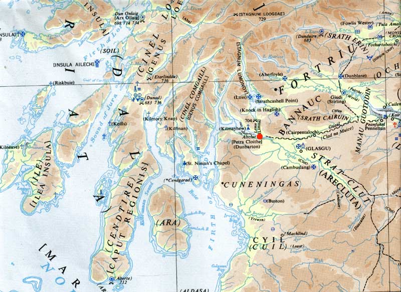
Extrait de la carte Ordnance Survey : Britain in the Dark Ages. |
![]()
|
Histoire; Archéologie : * Bède (voir Bibliographie) : - chap. I : parlant du Mur d'Antonin : "There is a very extensive arm of the sea (Firth of Clyde), which originally formed the boudary between the Britons and the Picts. This runs inland from the west for a great distance, where there stands to this day the strongly fortified British city of Alcluith. It was to the northern shores of this firth that the Scots came and established their new homeland". - chap. 12 , parlant de l'implantation des Scots : "" ... for two sea estuaries lay between, one of which runs broad and deep into the country from the sea to the east and the other from the west, althought they do not actually met. In the middle of the eastern estuary stands the city of Giudi (The island of Inchkeith), while on the right bank of the western stands the city of Alcluith, which in their language means 'the rock of Cluith', as it stands near a river of that name". * M.N Bouillet (1863) : DUMBARTON. la Balclutha d'Ossian et le Dumbritonium des Romains, ville d'Écosse, chef lieu d'un comté du même nom, à 80 km à l'ouest d'Edinbourgh; 3600 hab. Bon port franc; verreries, filatures, tanneries. Vieux château-fort. - Le comté de Dumbarton, situé entre ceux de Perth, Stirling, Lanark, Renfrew, la Clyde et la mer, à 75 km de long sur 9 km de large; il est traversé par le Grand-Canal et offre plusieurs lacs dont le principal est le Lomond. Montagnes, marais; sol peu fertile; bonne pêche; quelques industries. Voy. Argyle (Archibald II d'). * Kenneth H. Jackson (1969) : - p. 64 : "Now, during the course of the sixth ans seventh centuries the whole British North came into the power of Northumbria, with the vey important exception of Strathclyde; which, with its capital at Dumbarton, its religious centre at Glasgow, and its hertland the valley of the Clyde, but reaching probebly from upper Loch Lomond and Cunningham to Peebles and the source of the Tweed, held on to its interdependance for some threee and half centuries after the rest of southern Scotland had fallen to Northumbria". * Béatrice Balti (2019) : p. 15 : "En l'an 870, environ 200 drakkars remontèrent le fleuve Clyde et attaquèrent la forteresse royale de la capitale des Bretons à Dumbarton. Le siège dura plus de quatre mois et les Vikings réussirent à capturer et à faire prisonnier le souverain breton, un certain Artgal." |
![]()
|
i
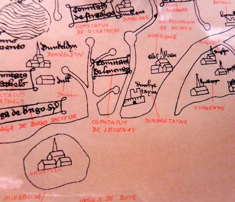
Extrait de Map of Great Britain Bodleian Library. Oxford Ordnance Survey Office. Southampton. 1870 |
![]()
|
Légende arthurienne. * Ronan Coghlan (1993) : "Alclud. The old name of Dumbaton. Hoel, King of Brittany and Arthur's ally, was besiegeg there by the Picts and Scots untils Arthur came to relieve him".
|
![]()
|
Étymologie. Gerdarzh : * M.N Bouillet (1863) : la Balclutha d'Ossian et le Dumbritonium des Romains. * Kenneth H. Jackson (1969) : - p. 76 : "One may compare the early Welsh names for Dumbarton, capital of Strathclyde. In Old Welsh this was Al(t) Clut, "'The rock of the Clyde", but other early sources call it also din Al Clud, caer al Clut, din Clut, and Caer Glut, and in Latin arx Alt Clut, which are likewise descriptive phrases rather than the true name". * Wikipedia : Scottish Gaelic: Dùn Breatainn, * Rivet & Smith, p. * A.D Mills : "Dumbrethan, c. 1290. 'Fort of the Britons'. Gaelic dùn. The name was applied by the neighbouring Gaels to the stronghold occupied from the 5th. cent. by the Britons, who called their fortress Alclut, 'rock of the Clyde'." |
![]()
| Personnes connues | Tud brudet | Wellknown people |
|
* Saint Gildas / Sant Gweltaz. |
![]()
|
Sources : * BEDE : A history of the English Church and People. Translated and with an introduction by Leo Sherley-Price. Revised by R.E. Latham. Penguin Books. 1968. * Ordnance Survey : Map of Great Britain. Bodleian Libray. Oxford. 1870. * Ordnance Survey : Britain in the Dark Ages. * Kenneth Hurlstone JACKSON : The Goddoddin. The Oldest Scottish Poem. Edinburgh at the University Press. 1969. * Norma Lorre GOODRICH : Le Roi Arthur. 1986. Arthème Fayard, 1991. * A.L.F RIVET & Colin SMITH : The Place-names of Roman Britain. Batsford Ltd. London. 1979. * Ronan COGHLAN : The Illustrated Encyclopaedia of Arthurian Legends. Element Books Limited. 1993. * A.D MILLS : Oxford Dictionary of Brirish Place-Names. Oxford University Press. 1981-2003. * page Wikipedia : Scottish Gaelic: Dùn Breatainn, * Béatrice BALTI ; Histoire de l'Écosse. Le point de vue écossais. Yoran Embanner. Fouesnant. 2019 |
![]()
|
Liens électroniques des sites Internet traitant de Dumbarton / Dùn Breatainn, Altclud : * lien communal officiel : * Wikipédia français : * Wikipedia brezhonek : * forum du site Marikavel : Academia Celtica * sauf indication contraire, l'ensemble des blasons figurant sur cette page ont été dessinés par J.C Even, sur bases de GenHerald 5. * Introduction musicale de cette page : Bro Goz Ma Zadoù, hymne national breton, au lien direct : http://limaillet.free.fr/MP3s/BroGoz.mp3 hast buan, ma mignonig, karantez vras am eus evidout go fast, my little friend, I love you very much |
![]()